The Dolomites can derail a trip faster than almost anywhere in Europe, and it’s rarely the trails that do it. It’s the rules around them. Toll roads that sell out weeks ahead, car parks that are full by 7am, lifts that quietly stop running the day you turn up. Get those wrong and you’re standing at a locked gate watching your hiking day evaporate.
So we’ve done the annoying part for you. Every trail below tells you when to arrive, how to get there without a car, where the crowds hit, and which rifugi are worth stopping at for lunch. Sort yourself into one of these three and start there:
- Easy / low-stress: lift-assisted ridges and meadow walks.
- Moderate classic: iconic loops with steady climbing.
- Challenging: exposed sections or long plateau traverses.
Each trail features a standard Trail Stats Card (distance, elevation gain, time, difficulty, trailhead, and best months) plus our exclusive fields: crowd tier, best start time, car-free access yes/no, and rifugio lunch stops.
Start with the icons, then use our crowd tiers and base-town guide to build your perfect 2-5 day plan.
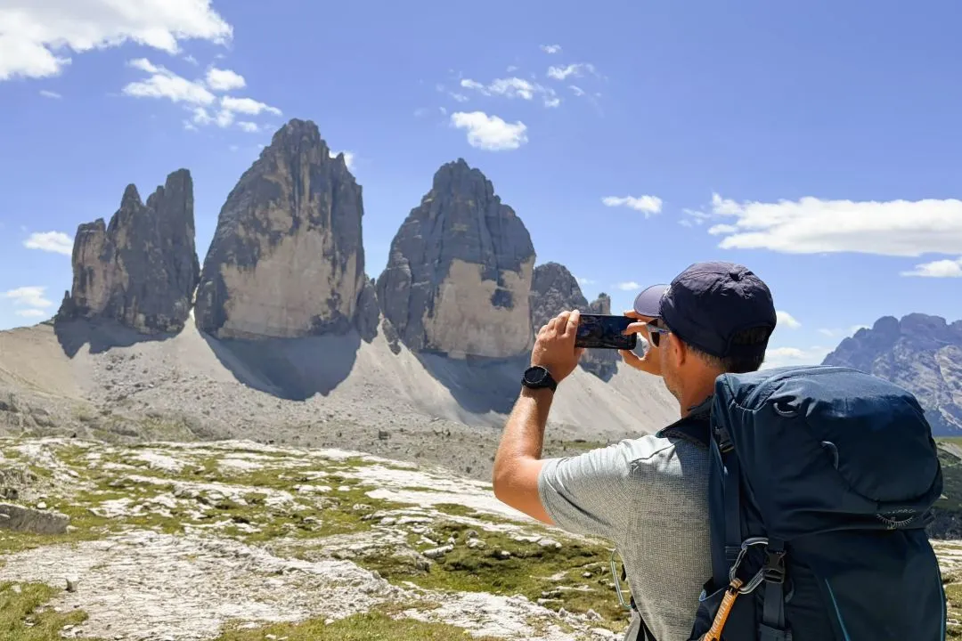
1. The Tre Cime di Lavaredo Loop & Cadini di Misurina Combo
Distance
~ 13 km (8.1 miles)
Elevation Gain
~ 450 m (1,475 feet)
Hike Time
~ 5 hours
Difficulty
Moderate (CAI: E)
Trailhead
Rifugio Auronzo
Best Months
Late June to early October
Crowds
Very High
Best Start Time
Before 7:00 AM or after 2:30 PM
Car-Free Access
Yes (buses from Dobbiaco or Cortina d’Ampezzo)
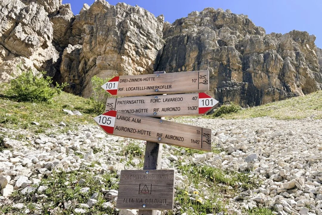
If you only have one day, this combination delivers the ultimate visual payoff. You’ll stand beneath the sheer 500-meter north faces, experience the dramatic reveal at Forcella Lavaredo, and catch the iconic view from Rifugio Locatelli.
The route follows the classic counterclockwise loop. Start at Rifugio Auronzo, hike to Rifugio Lavaredo, climb to Forcella Lavaredo, pass Rifugio Locatelli, and return via trail 105.
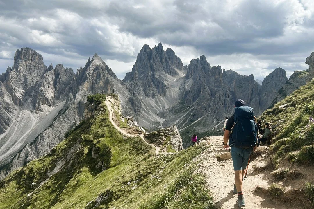
Logistics, not fitness, will dictate your day. The access road toll costs €40 and now requires an online reservation with your license plate – from late May through to October. So, book your slot in advance. If you’re going car-free, take the public bus from Dobbiaco, or the seasonal DolomitiBus service via Misurina if you’re coming from Cortina d’Ampezzo.
Break up the hike with lunch on the spectacular terrace at Rifugio Locatelli. Start at sunrise to guarantee quiet trails, or opt for a late-afternoon start during midsummer – obviously, starting then makes lunch at the rifugio difficult. Just remember the toll road (but also the rifugi) only operate from mid-June to mid-October, and shoulder season brings sudden snow risks.
A note on crowds here: Not everyone can arrive at once; hikers are generally spread out over the 10km and you will find a lot fewer people on the second half of the loop.
Tip: Hike the Cadini di Misurina viewpoint along trail 117 early or late; this way, you will usually find the shortest photo queue. It’s a short but spectacular addition!
2. Seceda Ridgeline: The High-Yield Panorama
Distance
9 km (5.6 miles)
Elevation Gain
350 m (1,150 feet)
Hike Time
3 hours
Difficulty
Moderate (CAI: E)
Trailhead
Ortisei-Seceda Cable Car Station
Best Months
Early June to mid-October
Crowds
High
Best Start Time
8:30 AM (First lift) or after 3:00 PM (but last lift down is 6 PM)
Car-Free Access
Yes (buses from Bolzano and Val Gardena towns)
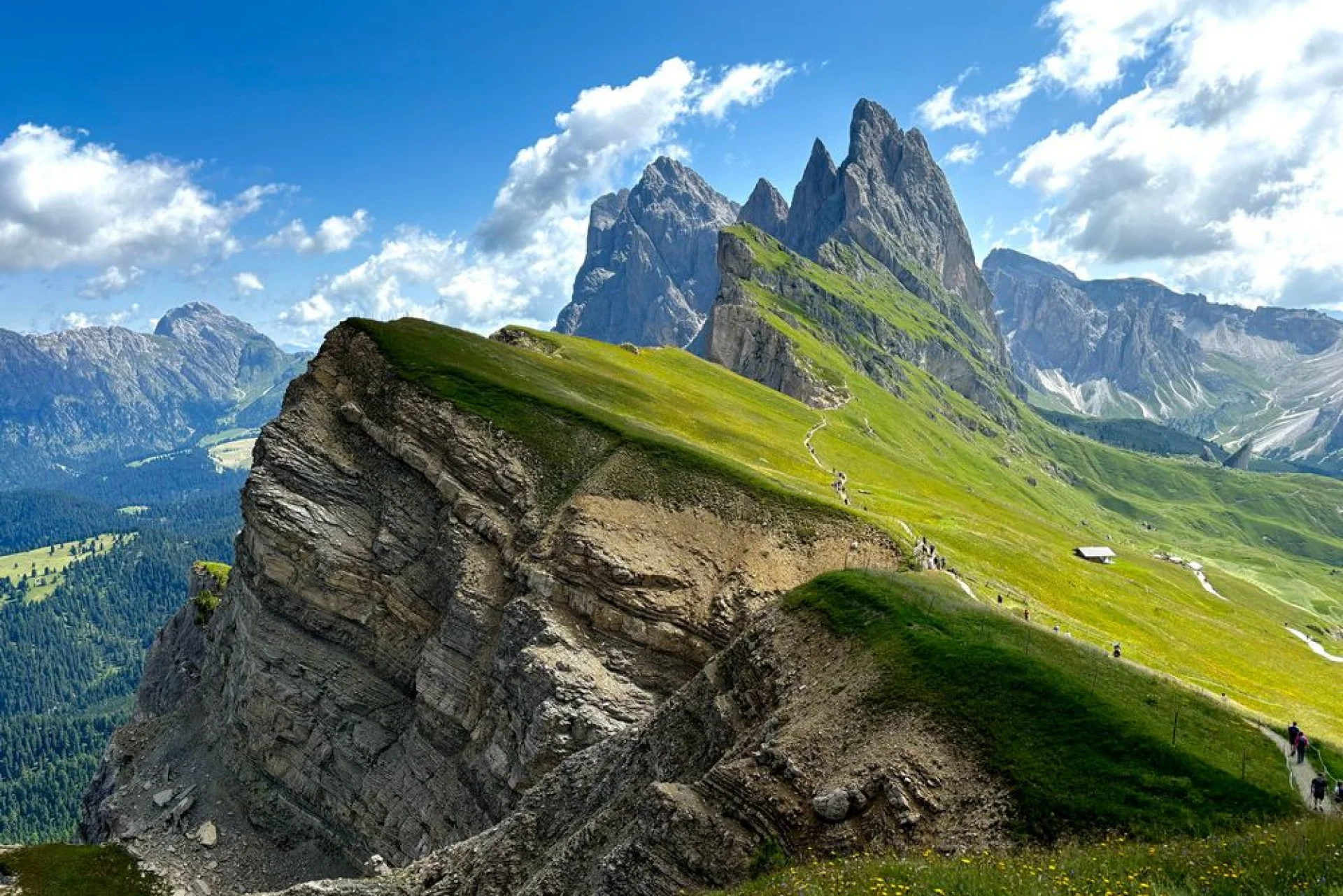
If you want a massive scenic payoff with minimal physical strain, Seceda is unbeatable. You will stand beside the iconic, sheer “shark-fin” peaks of the Odle group while enjoying a sweeping Val Gardena panorama.
Our favorite loop logic avoids backtracking. Ride the Seceda cable car up from Ortisei, traverse the ridgeline, and descend to the Col Raiser lift. From Col Raiser, take a local bus back to Ortisei. This is one of the easiest car-free hikes in the Dolomites, though drivers should note that Ortisei parking is very limited.
Be on the ridge with the 8:30 AM first lift to beat the mid-morning queues and harsh photographic light. For lunch, Baita Sofie is our default stop for its sunny terrace and classic South Tyrolean dishes.
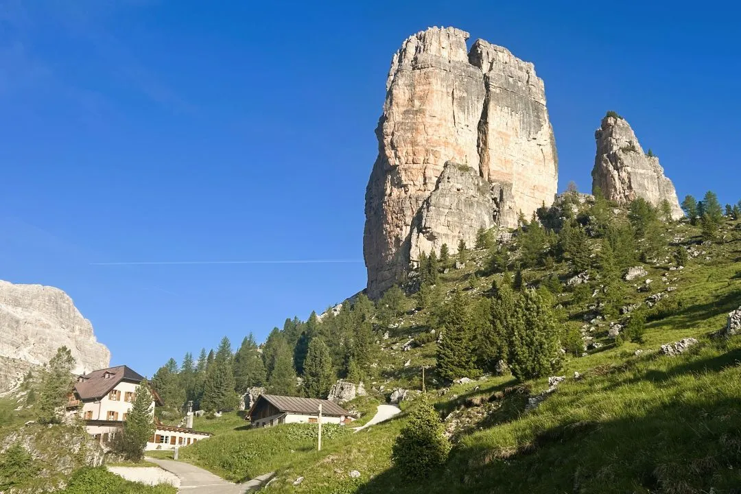
3. Cinque Torri & Nuvolau: WWI History and the Ultimate High-Altitude Lunch
Distance
6.8 km (4.2 miles) with Nuvolau
Elevation Gain
410 m (1,345 feet)
Hike Time
3 hours
Difficulty
Moderate (CAI: E)
Trailhead
Multiple Trailhead Options – Easy access
Best Months
June to September
Crowds
High
Best Start Time
9:30 AM
Car-Free Access
Yes (seasonal bus from Cortina d’Ampezzo)
When mountain weather is mixed, this trail delivers the ultimate “Dolomites in a day” experience. The 6.8-kilometer route climbs to the summit, but you can scale back to the flatter 3-kilometer loop. You will experience:
- Giant limestone towers
- Restored WWI trenches and bunkers
- Panoramic views of Cortina peaks
- And lunch at 2,575 meters
Ride the Bai de Dones chairlift to start. Loop the Cinque Torri formations, then climb the steady path to Rifugio Averau. Push up the final rocky ridge to Rifugio Nuvolau. Here, the experience is all about terrace time, eating a hot plate of canederli suspended over a sheer drop.
Chairlift access means key viewpoints get busy. If driving, aim to arrive before 9:00 AM to secure parking; this also times your summit arrival perfectly with lunch. If traveling car-free, take the seasonal Dolomiti Bus from Cortina d’Ampezzo to the lift base. When lifts are closed in the shoulder season, you can still hike from the road – there are plenty of trail options.

4. Lago di Sorapis: The Milky Turquoise Jewel
Distance
13 km (8.1 miles)
Elevation Gain
~500 m (1,640 feet)
Hike Time
5-6 hours depending on time around the lake
Difficulty
Moderate (CAI: E)
Trailhead
Passo Tre Croci
Best Months
July to September
Crowds
Very High
Best Start Time
Before 7:30 AM
Car-Free Access
Yes (seasonal bus from Cortina d’Ampezzo)
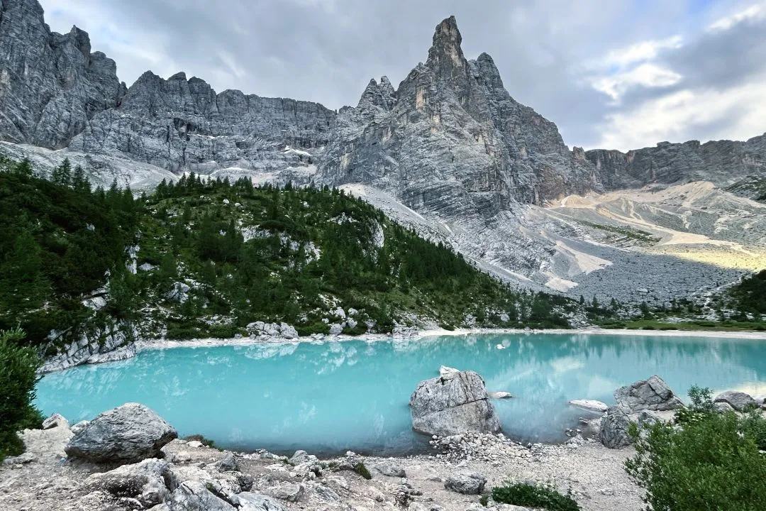
The draw is obvious: a surreal, milky turquoise basin cradled by colossal peaks. Glacial snowmelt makes this color brightest in early summer; by autumn, the water level drops and the hue fades.
The baseline route is an out-and-back. Confident hikers can tackle the rugged loop over the high pass, but the standard path has real hazards. You will navigate a couple of narrow ledges and exposed sections with fixed cables, while keeping in mind the slick limestone can be dangerous when wet. Always yield to uphill hikers on narrow passages.
Stepping off before 7:30 AM is non-negotiable. Parking at Passo Tre Croci fills VERY early, and the small lakeside area feels choked by noon. Car-free hikers can use the seasonal bus from Cortina d’Ampezzo, but schedules can change frequently.
Rifugio Vandelli offers a simple lunch, with a BBQ section often open till later in the afternoon. However, they are a small hut and tables, and lunch is at a premium. Shoulder-season hikers will find closed services and high risks of lingering ice. If you like the idea of doing Sorapis and Tre Cime back-to-back without deciphering the toll roads, which trails to take and when, bus timetables, and rifugio bookings separately for each one, our Lake Sorapis & Tre Cime di Lavaredo hut-to-hut trek links both into one multi-day route with all reservations handled for you.

5. Croda da Lago Circuit: The Autumn Larch and Mirror Lake Classic
Distance
12.8 km (8 miles) loop
Elevation Gain
~860 m (2,820 feet)
Hike Time
4.5 – 5 hours
Difficulty
Moderate (CAI: E)
Best Months
Late-September to October
Crowds
Manageable (higher in autumn)
Car-Free Access
Yes (buses from Cortina)
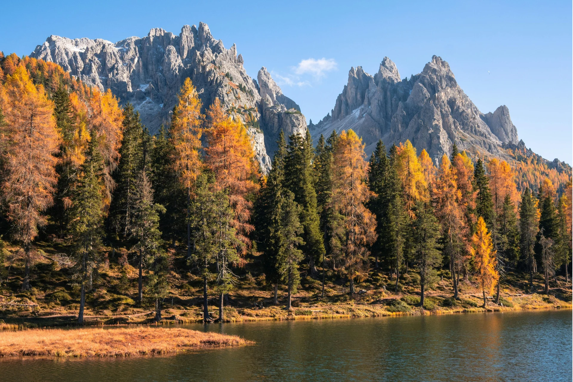
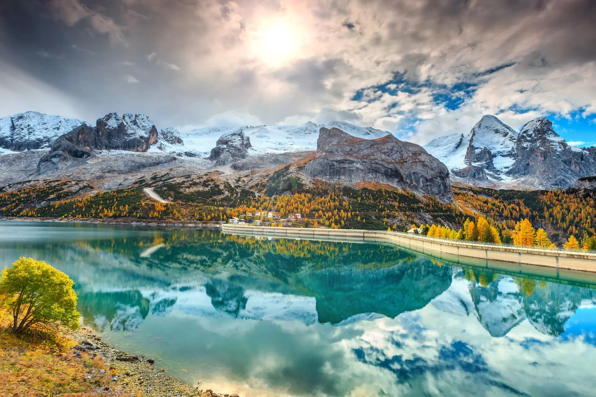
If you want a high-reward hike without the Tre Cime chaos, the Croda da Lago circuit is your perfect quieter classic. The trail winds through dense larch forests that erupt into fiery gold from late September through October. At Lago Federa, the jagged needles of the Croda da Lago ridge mirror perfectly in the glassy water, making this one of the region’s best late-season options due to its lower, snow-resistant elevation.
Follow the path to the lake and rifugio Croda da Lago, completing the loop via Forcella Ambrizzola if the conditions are clear. Time your hike to arrive at the rifugio in the late morning or early afternoon for a warm, hearty mountain lunch.
Roadside parking at Ponte di Rocurto is limited. You may miss out on a spot if you roll in after 9:00 AM. For car-free travel, take the seasonal bus from Cortina toward Passo Giau, hop off at the junction, and walk the final road stretch to the trailhead.
Start early to secure parking, though late-autumn hikers might delay slightly to balance daylight with warmer temperatures.
Pro Tip: Photographers should target early morning for still, windless conditions at Lago Federa. Afternoon breezes typically pick up and break the perfect mirror reflection.
6. The Adolf Munkel Trail: Low-Stress Odle Views and Alpine Dining
Distance
9 km (5.6 miles) loop
Elevation Gain
~400 m (1,310 feet)
Hike Time
3 hours
Difficulty
Easy to Moderate (CAI: T/E)
Trailhead
Zannes (Zans) Parking Lot
Crowds
Manageable
Best Months
Late May to late October
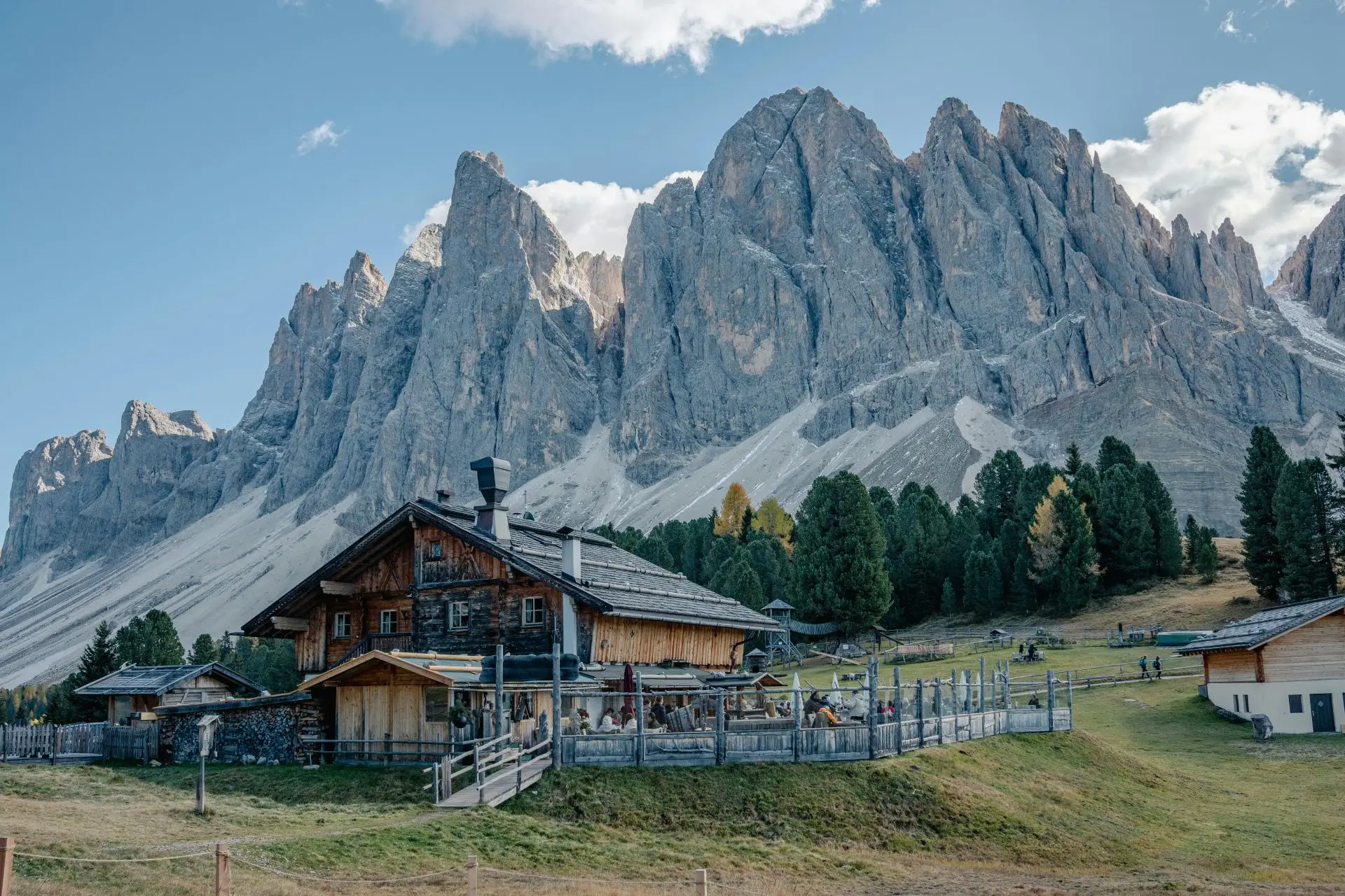
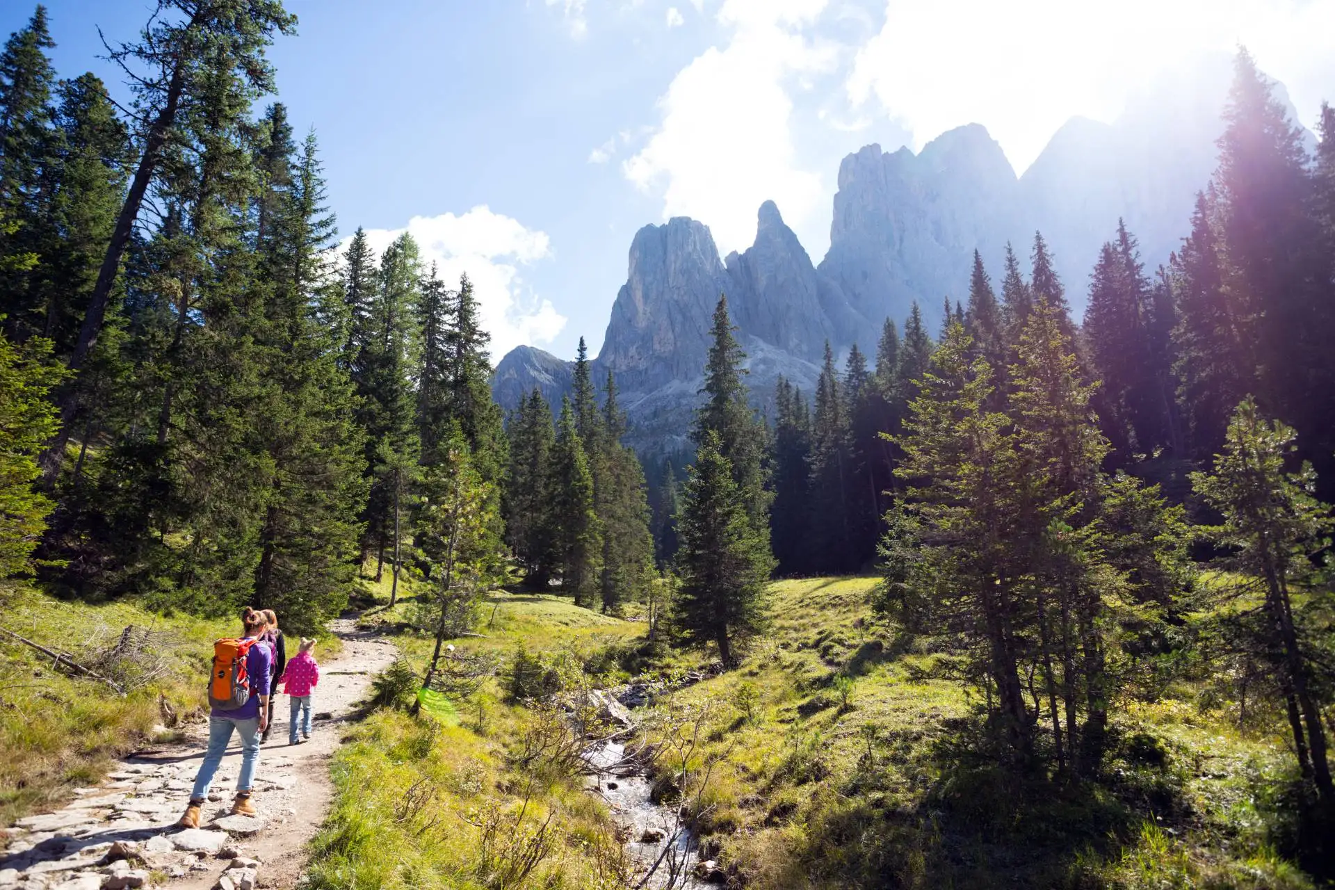
If you want to stand beneath the sheer, vertical faces of the Geisler spires without grueling high-altitude climbs, this trail is the perfect recovery-day option. The gentle, beginner-friendly loop starts from the Zannes parking area in Val di Funes. You’ll wander through quiet pine forests before emerging into rolling alpine meadows directly below the jagged stone peaks. While the parking lot fills early in peak summer, it lacks the chaos of Tre Cime.
If you’re traveling car-free, take the public bus from Bressanone or Chiusa into Val di Funes, then the local shuttle to Zannes. Note that if the shuttle isn’t running, walking the final segment from Ranui adds extra uphill mileage.
We recommend a late-morning start to reach Geisler Alm for lunch. Secure an outdoor terrace table, order something local, and carry cash since phone signal is not always great out here. Since these lower pastures are highly accessible, the huts here open earlier and close later than high-alpine rifugi.
Pro Tip: If your trip is in late May or early June, this is a much smarter, snow-free bet than higher-elevation “Instagram classics.”
7. The Puez Plateau Traverse: The Ultimate Single-Day Hut-to-Hut Experience
Distance
15 km (9.3 miles)
Elevation Gain
~450 m gain / ~1,100 m loss
Hike Time
5.5–6 hours (longer day)
Difficulty
Challenging (CAI: EE)
Trailhead
Dantercepies Gondola (Selva Val Gardena)
Crowds
Moderate (thins out after the first hour)
Best Start Time
Before 8:30 AM
Want the wild immersion of a multi-day trek without the headache of booking mountain huts months in advance? This point-to-point crossing of the Puez-Odle Altopiano is the ultimate day-hike substitute, offering a true hut-to-hut vibe in a single day.
The route begins with a lift-assisted start from Selva via the Dantercepies gondola. After climbing past the Cir peaks, you enter an otherworldly, lunar karst plateau with constant 360-degree panorama shifts. Start before 8:30 AM to stay ahead of the afternoon storm window on this high-altitude trail. This plateau also holds snow late into June, so early-season hikers should prepare for micro-adjustments.
This is a pure point-to-point journey where you descend through the glacial canyon of Vallunga to a completely different valley point. Without a car, summer buses make the “start here, end there” logic highly doable. There is no single parking chokepoint to worry about, meaning the real logistical challenge is simply timing your buses and committing to the long trail early.
Pro Tip: Aim to reach Rifugio Puez before the peak 1:00 PM lunch wave. It is the perfect mid-route reset point to refuel with Tyrolean dishes before the steep descent.
8. Mount Lagazuoi: The WWI Tunnel Descent and Panoramic Ridge
Distance
4.5 km (2.8 miles)
Elevation Gain
50 m gain / 640 m loss (recommended variant: lift up, hike down)
Hike Time
2–3.5 hours
Difficulty
Moderate (CAI: E)
Trailhead
Passo Falzarego Cable Car
Best Months
Late June to early October
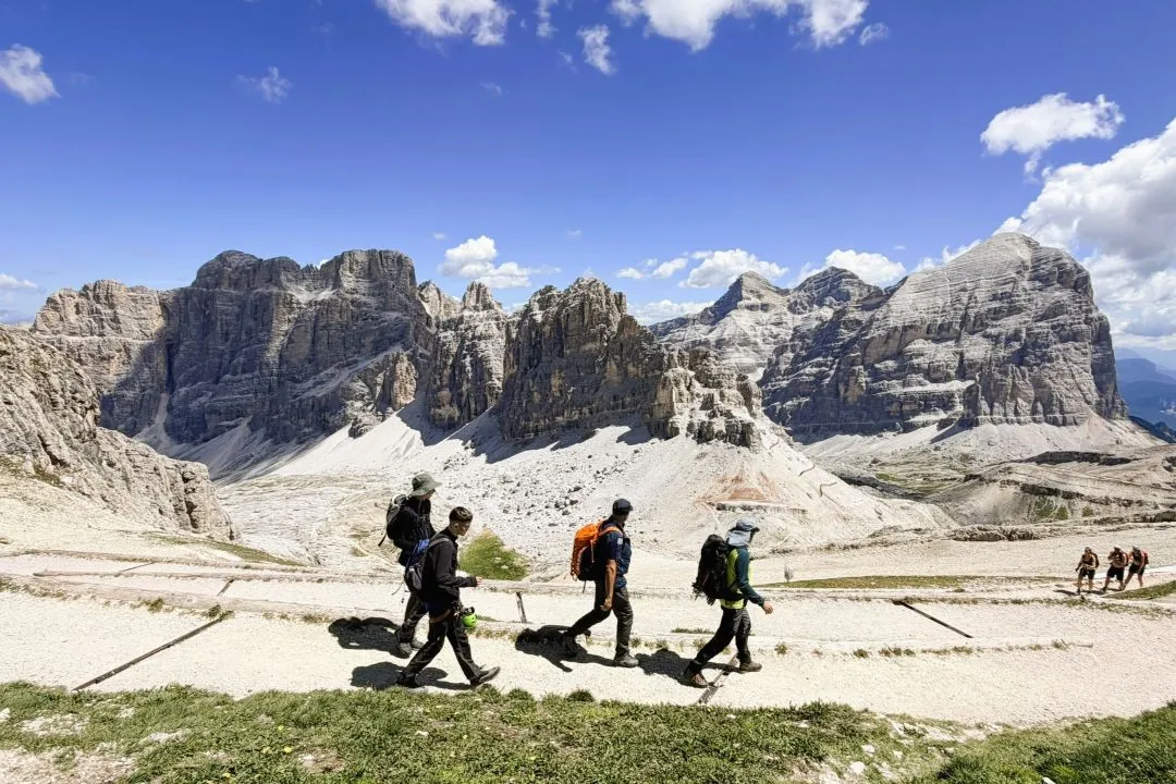
Lagazuoi is a smart choice when the forecast looks shaky. The cable car does the climbing, so you’re never far from a quick exit if the weather turns, and you can pack a lot of scenery into a short window: 360-degree views over the Tofane and Marmolada from the moment you step off at the top.
From the summit, you descend through the Lagazuoi Open-Air Museum — a network of restored WWI trenches and fortifications carved into the mountain. There’s an optional variant that drops you inside the mountain through a 1 km long historic tunnel, which is well worth doing if you’re prepared for it. It calls for:
- A headlamp
- Careful footing on wet, uneven rock
- An extra hour or so of walking time
Before you drop below the top station, stop at Rifugio Lagazuoi for a coffee on the terrace – the view from that deck is one of the best you’ll get sitting down anywhere in the Dolomites.
If you’re coming without a car, regular summer buses link Passo Falzarego with Cortina d’Ampezzo. And if you’re visiting in the shoulder season, always check the lift is actually running before you commit to the drive.
Pro Tip: Pack a light windproof layer, even in mid-summer. It’s exposed up there, and the wind at this 2,752-meter summit often turns bitterly cold the moment you stop moving to sit for lunch.

9. Alpe di Siusi: The Ultimate Meadow Walk and Car-Free Haven
Distance
8.5 km (5.3 miles) loop
Elevation Gain
180 m (590 feet)
Hike Time
2.5 hours
Difficulty
Easy (CAI: T)
Trailhead
Compatsch (Compaccio)
Best Months
Late May to late October
Crowds
Dispersed & Manageable
Best Start Time
Late morning or late afternoon
Car-Free Access
Yes (Excellent)
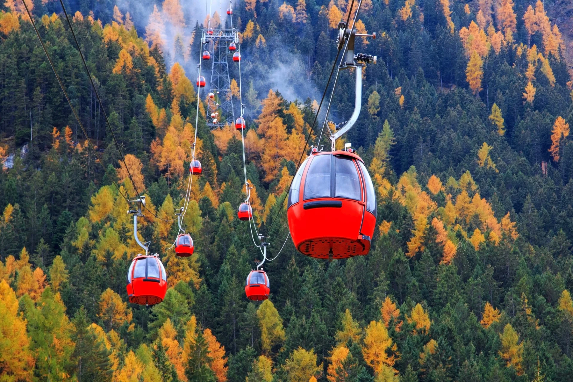
Alpe di Siusi is a car-free plateau by day, and that’s the thing to plan around. When the cable cars run, the access road closes to private traffic from 9:00 AM to 5:00 PM, and on busy weekends it shuts even earlier once the car parks fill. From summer 2026, the P2 Compatsch car park also needs an online reservation booked ahead. Skip the driving headache entirely: this route runs car-free from end to end.
Ride the Mont Sëuc gondola up from Ortisei to the plateau’s northern edge at roughly 2,000 m. From there the trail rolls south through open meadows to Baita Sanon (the Sanonhütte in German) at 1,849 m, with the plateau’s signature view across to Sassolungo. Drop to Saltria, the low point of the walk, then climb gently back out on Trail 30, the historic Hans & Paula Steger Weg, finishing at Compatsch — no backtracking, and the cable car and buses down to Siusi wait right there.
Treat the day as a hut-to-hut lunch crawl. Baita Sanon serves traditional South Tyrolean and Ladin cooking and is the natural mid-route stop, though it’s a solid hour out from Compatsch. Rauchhütte nearby is another strong choice for Tyrolean specialties and Sassolungo views. Come in early summer for the wildflowers, or use the plateau’s low altitude for shoulder-season hiking when the high passes are still snowed in.
10. Lago di Braies: The Crowd-Free Strategy for the Dolomites’ Most Famous Lake
Distance
3.6 km (2.2 miles) loop
Elevation Gain
50 m (160 feet)
Hike Time
1.5 hours
Difficulty
Easy (CAI: T)
Trailhead
Lago di Braies
Best Months
May to November
Crowds
Very Busy
Best Start Time
As early as possible to miss crowds
Car-Free Access
Yes (buses from Dobbiaco or Cortina d’Ampezzo)

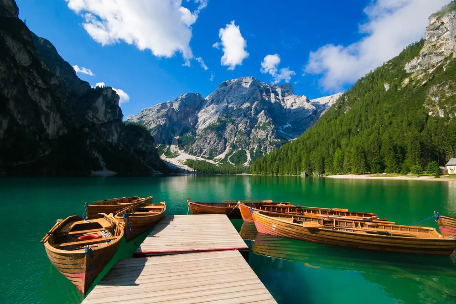
We’ve all seen the postcard: wooden rowboats on glassy, emerald waters. But at midday, Lago di Braies becomes a wall of selfie sticks. You can still have a magical experience here, but you need a strict strategy.
To thin the crowds, hike the 3.6-kilometer loop counterclockwise. The classic boathouse view greets you at the start, but the full circuit leads you away from the main shore into quiet, forested paths.
The parking reality is brutal. In peak season, vehicle access is strictly regulated, and close-by lots fill before 8:00 AM. Going car-free is your best bet; the public bus from Dobbiaco connects directly to the lakefront.
For food, lakeside dining is average convenience-first. Skip the cafes, pack your own lunch, and find a quiet part on the pebble beach on the far shore.
Timing is everything. Arriving at sunrise is the entire point; the serenity evaporates by 9:30 AM. Thanks to its lower elevation, you can hike here earlier in spring and later in autumn than on high-altitude trails, though shoulder-season weekends remain busy.
Tip: Treat Braies as a half-day trip and pair it with a quieter nearby walk (see our pairing guide).
How to Design Your Perfect Dolomites Day Hiking Itinerary
Match Your Difficulty in 60 Seconds
- Easy (T): Hike Alpe di Siusi or Lago di Braies. Best for recovery, families, and casual strolls.
- Moderate (E): Hike Seceda, Cinque Torri, or Croda da Lago. Great for active walkers seeking steady climbs.
- Confident Hiker (EE): Face Lago di Sorapis or Puez Plateau. Skip these steep routes in poor weather.
Our Realist Crowd Tier System
- Iconic & Busy: Visit Tre Cime and Lago di Braies. Beat crowds by starting at sunrise.
- Scenic & Manageable: Hike Seceda or Cinque Torri. Enjoy wide spaces that let you spread out.
- Hidden & Quiet: Choose Adolf Munkel or Puez Plateau. These offer your quietest mountain escapes.
Regional Clustering by Base Town
- Cortina d’Ampezzo: Gruppo Cinque Torri, Lago di Sorapis, Croda da Lago, and Lagazuoi.
- Val Gardena: Choose Seceda, Puez Plateau, and Alpe di Siusi.
- Alta Pusteria: Stick to Tre Cime, Lago di Braies, and Adolf Munkel.
Combo-Day Pairings
- The Iconic Duo: Pair Lago di Braies at sunrise with Tre Cime late afternoon. Drive 1 hour between trailheads.
- The Crowd-Smart Day: Hike Adolf Munkel early, then ride afternoon lifts up Seceda for ideal photography light.
- The Weather Hedge: Pair Cinque Torri with Lagazuoi, both a short drive apart near Passo Falzarego, and both lift-served, so you can see a lot in a few hours and get down quickly if the forecast turns. Ideal for a day when you don’t trust the afternoon sky.
If juggling toll bookings, bus timetables, and rifugio lunch windows across ten different trails feels like a lot to coordinate solo, browse our self-guided hiking packages – the reservations and daily pacing are handled, and you still hike independently.
Hut-to-hut Hiking ToursMicro-Logistics Checklist
- Start early: Reach major trailheads before 7:30 AM to secure parking.
- Carry cash: Keep physical Euros on hand for hut toilets and snacks.
- Check lift dates: Verify cable car operating calendars online before departing.
- Have a Plan B: Pivot to your closest regional cluster if parking is full.
Hit the Trail
Select two to four of these best day hikes in the Dolomites based on your base town and crowd tolerance. You’ll easily transform these classics into an executable itinerary. Pack your gear and hit the trail.
Practical Information
A few numbers and logistics apply across nearly every trail on this list, so we’ve pulled them into one place instead of repeating them ten times.
Costs
- Tre Cime toll road: €40 per car, online reservation required in peak season.
- Cable cars and chairlifts: typically €20–€49 return per person, depending on the lift and valley.
- Rifugio lunch: €15–€25 for a hot meal; coffee and strudel €6–€10.
- Regional multi-day lift passes: worth pricing against your planned route count before you buy individual tickets.
- Parking: free roadside lots exist at quieter trailheads, but iconic starts like Tre Cime and Lago di Braies charge or restrict access entirely in summer.
Booking
Book the Tre Cime toll road and any Lago di Braies parking or shuttle slots online, and do it weeks ahead in July and August — both sell out. Bus tickets for routes like the Dobbiaco shuttle or the seasonal Cortina d’Ampezzo lines can usually be bought the day before through the regional transit apps, but don’t leave it to the morning of a peak-season Saturday. Lifts and cable cars don’t require advance booking (except for Seceda); just check that they’re running the day you plan to ride, since summer schedules shift by valley and by season.
Access
Most lift-assisted trails on this list only run from mid-June to mid-October; outside that window, you’re hiking from the valley floor, adding hours and elevation. Shoulder-season visitors (late May or November) should expect closed rifugi, no cash-back options at trailheads, and a real chance of snow at altitude. Always carry cash in euros; card readers at rifugi and mountain kiosks sometimes lose signal, and it’s your only reliable way to pay for a hot lunch or a toilet.
Now Go Hike!
We’ve hiked these trails in every mood the Dolomites can throw at them; mirror-still mornings at Braies, whiteouts on the Puez plateau, golden autumn larches at Federa. The scenery is never the problem here. The planning is, and now you’ve got that covered.
Choose a couple that fit your trip, handle the bookings early, and go. And if the logistics still feel like a lot to juggle solo, that’s exactly what we’re here for.
View Posts By Topic
FAQ
Yes, and I’d go further – it’s the single most important item in your pack. Afternoon storms are a consistent pattern here in summer, not occasional bad luck. A packable, hooded, genuinely waterproof shell (not water-resistant) also functions as your primary windbreak on exposed ridges where temperatures drop fast. Never leave the trailhead without it.
Lightweight hiking boots. For loose scree, wet rock slabs, and steep descents, ankle stability is more valuable than the speed advantage of trail runners. Trail runners work well for experienced mountain hikers on dry, well-graded paths. If you’re new to this terrain, the boot is the safer choice.
June means colder mornings, a warmer mid-layer requirement, and the real possibility of snow patches on north-facing slopes above 2,000 meters; waterproof boots earn their keep.
August allows lighter base layers and shorts during the heat of the day, but the afternoon storm frequency actually increases mid-summer. A waterproof shell is non-negotiable in both months.
Clean and simple – most wear mountain or active wear. The atmosphere is casual mountain, not formal. The one rule that matters: boots come off at the door. Bring lightweight slippers, sandals, or slides to wear inside the hut. Don’t bother packing anything “city smart,” it’ll just take up space you need for hiking layers.
Yes, if you’re using merino wool. A quality merino base layer can handle two or three consecutive days of hiking without becoming offensive; it genuinely resists odor in a way that synthetic fabrics don’t match.
A quick sink wash at a rifugio, and it dries overnight. This is the main reason I’d push merino over any other base layer material for multi-day trips.